Geotab announced its new website provides data to inform smart city planning, increased business productivity and safer societies.
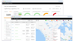
The statistics available include billions of data points gathered from more than one million vehicles that use Geotab telematics devices. Organizationally, the website contains pages for weather, location analysis and urban infrastructure, all of which can be used to increase citywide efficiency, uncover crucial obstacles to infrastructure, and lead integrated solutions for the city’s betterment. These include parking, congestion and poor road conditions.
Under the hazardous driving areas section, data targets areas of improvement based on aggressive braking and accidents in a specific geographic location. Road impediments includes data to flag abnormalities like potholes, speed bumps and surface issues from deviations in a truck’s up and down movements. Another category, searching for parking, provides data for spots in cities that are notoriously bad for parking.
In order to produce this data, GPS location, accelerometer data, seat belt usage, speed, engine diagnostics and other similar information is collected from the fleet’s digital device.
Geotab’s chief executive officer Neil Cawse said that in 2018 the company’s platform reached one million connected commercial vehicles.
“Now, we’re proud to be the one of the first resources to provide actionable insights from our global sensor network to help empower businesses and contribute to a rich data ecosystem that will further innovate the world - one community at a time,” said Cawse.
The City of Columbia implemented the Smart City dataset into their Smart Columbus Operating Systems, and plans to capitalize on the combined data from the city and the platform. The overall goal is to build sustainable practices and decrease waste.
Geotab’s vice president of data and analytics Mike Branch said this information could be applied on a much larger scale.
“Communities around the world will be able to leverage the intelligent data from data.geotab.com to better understand patterns in transportation, traffic, road conditions and more which will help prioritize safety measures among their communities,“ Branch said. “Each dataset, including weather, urban infrastructure or location analytics, will advance driver and road safety measures, ultimately paving the way for safer, more sustainable and advanced smart city development.”