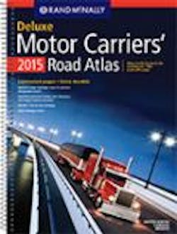
Rand McNally publishes 2015 road atlas
Rand McNally has released the 2015 edition of the Motor Carriers’ Road Atlas. The printed trucking atlas, in its 34th edition, continues to be a guide for over-the-road and other large-vehicle drivers.
Updated annually with new routes and critical state safety information, and cross-referenced to Rand McNally’s IntelliRoute TND devices, the new edition includes content specifically tailored to the needs of the commercial truck driver. The 2015 edition includes:
•Revised state and province maps, including updated mileages in the state mileage guides.
•Updated highways showing the latest truck roadways as designated by the Surface Transportation Assistance Act (STAA), also known as “designated” highways.
•Coverage of hazardous materials regulations.
•A 22-page mileage directory with more than 40,000 truck-route-specific, city-to-city mileages.
•Fully updated state and province charts including more than 500 changes to truck-specific state contacts—such as operating authority contacts, emergency police, and vehicle registration.
The 2015 edition year also marks the return of the Large Scale Motor Carriers’ Road Atlas to wide-scale distribution in travel centers. This version of the atlas features maps that are 37% larger than those in the regular Motor Carriers’ Road Atlas; anti-glare, tear- and water-resistant pages; and a spiral binding for stay-flat pages.
The Motor Carriers’ Road Atlas is available in paperback format, in a spiral-bound, laminated Deluxe version, as well as the Large Scale edition.
Learn more at www.randmcnally.com.

