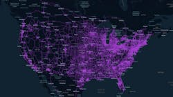
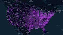
Netradyne’s Driveri has mapped (and re-mapped) 1 billion miles of U.S. roads
Netradyne’s vision-based driver recognition safety program has mapped data from vehicles traveling more than 1 billion miles on U.S. roads, which could help create the pathway for safer autonomous vehicles of the future.
The company announced the news about its Driveri program on July 21, adding that the data includes 1.8 million unique miles, which it claims is more than any other vision-based driving system. Netradyne is an artificial intelligence (AI) and edge computing technology company that focuses on driver and fleet safety. There were 4.18 million miles of roads in the U.S as of 2017, according to the Federal Highway Administration.
This data collected by the Driveri system is deployed in fleet vehicles around the U.S. It includes many passes over the same roads to provide deeper insights into how driving and different road conditions might change over hours, days and weeks.
Driveri uses a four-camera system that looks both within and outside the vehicle, continuously analyzing driving scenes and road data while monitoring drivers for driving behavior using AI embedded into the edge computing device. It captures various road and traffic scenarios, such as commercial driveways, temporary road closures, frontage roads, school zones and more.
"In addition to mapping more than a billion miles, we are creating a unique database from which to study the trends and patterns regarding accidents and changing roads,” said Avneesh Agrawal, CEO of Netradyne. “This rich data not only is critical for fleet companies and insurers to make our roads safer but ultimately this data will be immensely valuable to the systems of autonomous vehicles, where the training data is imperative.”
Agrawal added that his company’s data can be used to help train autonomous vehicle ecosystems that currently rely on pricey surveys, specialized equipment, and human review. “Rather, they can lean on the data collected by our Driveri platform in order to gather real-time insights and alerts that will improve safety and optimize overall fleet operations,” he said. “The more miles humans are safely able to drive today will help the autonomous vehicles of the future drive safely, but only if we have the data to use to train those future systems.”
Netradyne’s maps are generated in real-time and crowdsourced from Driveri devices that are deployed in commercial vehicles. Using proprietary real-time computer vision algorithms on the edge and crowdsourcing in the cloud, Netradyne generates and updates maps without requiring human intervention.
About the Author
Josh Fisher
Editor-in-Chief
Editor-in-Chief Josh Fisher has been with FleetOwner since 2017. He covers everything from modern fleet management to operational efficiency, artificial intelligence, autonomous trucking, alternative fuels and powertrains, regulations, and emerging transportation technology. Based in Maryland, he writes the Lane Shift Ahead column about the changing North American transportation landscape.


